

Monitoring river landscapes and floodplains in the Pacific
April 4, 2024
One way the Crawford Fund supports and encourages the next generation of Australians in study, careers and volunteering in international agricultural research is through our highly sought after Student Awards. They are funded by our State and Territory Committees and made possible by organisations including ACIAR, international centres, Australian and overseas universities and NGOs which welcome the students into their projects.
Please note applications for our 2024 Student Awards are currently open!
We would like to share the experience of Nicholas Metherall, from the Australian National University, who travelled to Fiji as part of his Student Award research to use Geographic Information System (GIS) and remote sensing to measure, report and verify agricultural landscapes.
“The project aims to monitor river environments in agricultural floodplains in the Pacific, and to develop measurement, reporting and verification guidelines for agricultural landscapes to improve farmers’ and landholders’ access to participation in carbon credit certification processes and carbon market income streams,” said Nicholas.
The research aimed to include:
- GIS and remote sensing to map agricultural catchments with landcover and landuse classification.
- Use of carbon accounting modelling software such as Full Carbon Accounting Model (FullCAM) and NatCAP.
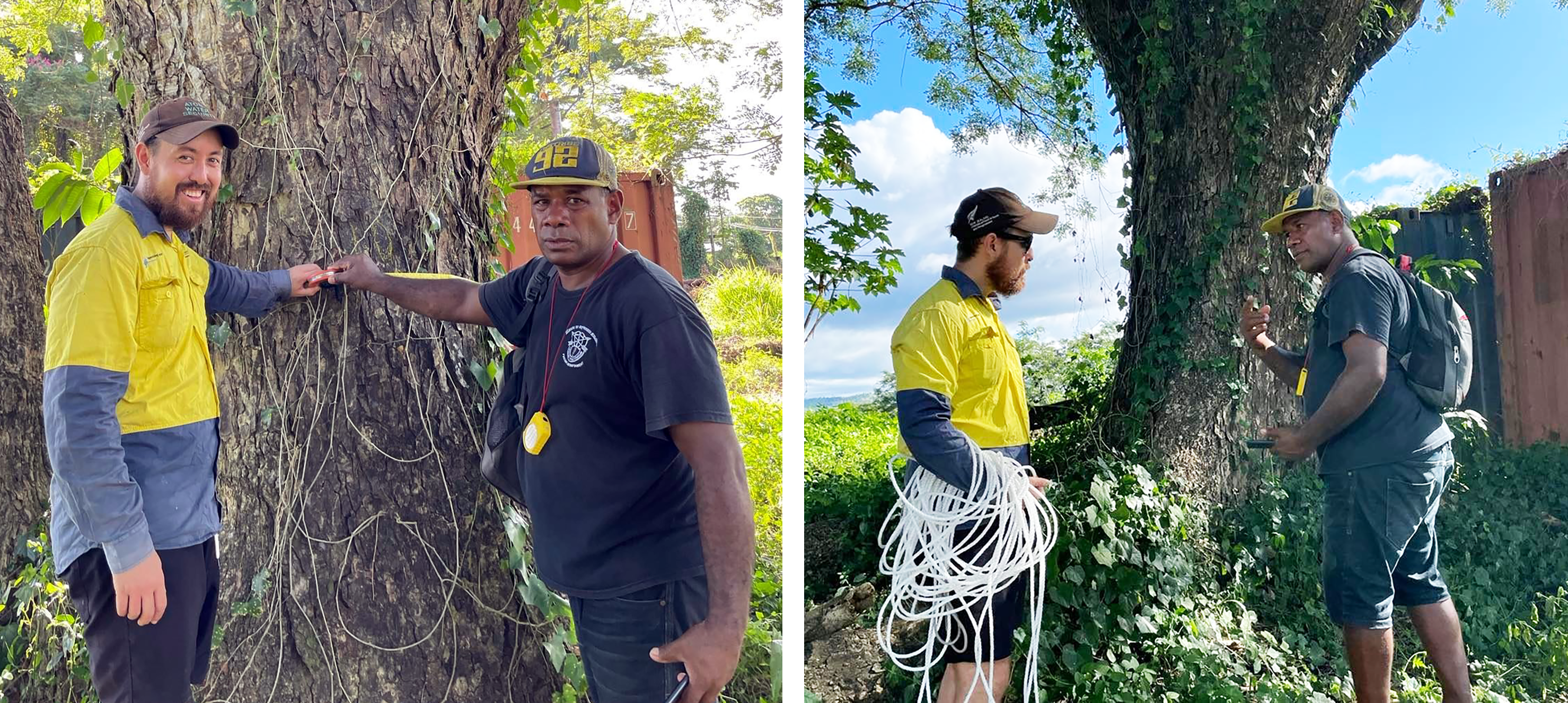
- Fieldwork including soil and water quality as well as tree measurement sampling at sites with geotagging to calibrate and validate mapping and modelling.
“Catchments cannot be studied as discrete or isolated systems. What happens on the land is likely to have significant impacts on waterways, estuaries and coastal oceans. This study seeks to address the risk of this siloed approach through considering interconnected relationships between upstream and downstream ecosystems,” he said.
Nicholas’ research activities were undertaken across four stages:
- River water quality sampling
- Capacity building in forestry inventories
- Field surveys and forestry inventories
- Results of geospatial / remote sensing analysis
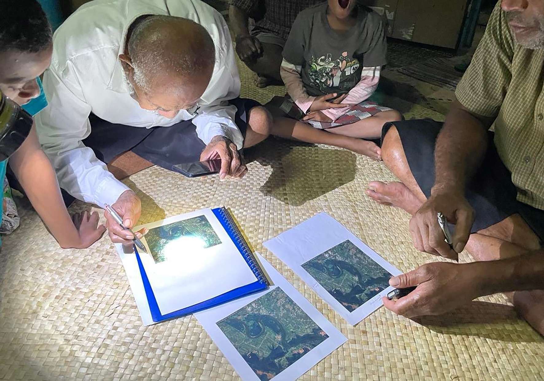
Capacity building with local research assistants from Fiji was a key component of the research. This involved showing the team how to use the equipment and how and why to measure particular dimensions of trees as part of the riparian vegetation and forestry inventories explained Nicholas.
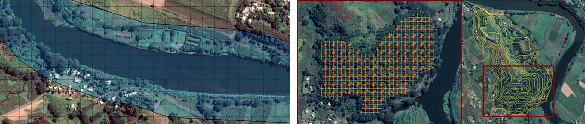
“After completing the capacity-building stages with a number of research assistants and village community members, a series of surveys were conducted across multiple areas of the riparian buffer corridor. The surveys were aided by GIS and remote sensing techniques including generating grids to support randomised sampling across various sites along the Ba River,” he said.
Further sites were highlighted including larger forested areas adjacent to areas protected by village communities. These areas were also analysed using GIS and remote sensing including through the use of Digital Elevation Models (DEMs) to build contour maps.
The researchers also looked at the distribution of native and exotic tree species. The findings of the forestry inventory so far have been that the lower floodplain of the agricultural Ba catchment was almost entirely composed of secondary (non-native) forest tree species.
A key part of the study explores the role of riparian vegetation in providing regulating services in agricultural landscapes including:
- Filtering agricultural runoff
- Stabilising stream banks
- Reducing erosion
- Reducing risk of streambank collapse
- Increasing soil infiltration capacity and reducing flood risk
Boat surveys up and down the Ba River were also undertaken to mark out important sites including areas of different riparian vegetation, land cover change, agricultural practices, erosion and streambank collapse. This included the site of a streambank collapse event in 2012 due to La Nina flooding. The boat surveys also identified areas of gravel extraction along the Ba River which has also impacted water quality.
Flood prone areas were also surveyed and monitored as part of the fieldwork.
“Some preliminary results are captured in Geographic Information Systems (GIS) Software including QGIS and some additional analysis has been done using remote sensing in GIS, Google Earth Engine and Microsoft Planetary Computer,” concluded Nicholas.


